It was incredibly sad to hear about the huge fire that destroyed much of the Grand Pier at Weston-Super-Mare last week. Fortunately no-one was injured in the fire, which firefighters said started in an area containing deep fat fryers.Â
Grand Pier in flames
As with many seaside towns, the pier is an icon of Weston’s seafront and a focal point for most tourists visiting the town.
According to Visit Somerset, part of the pier has already re-opened to visitors. As well as enjoying the attractions at the landward end of the pier, visitors can also walk along most of the length of the pier deck and see for themselves the effects of the fire on the pavilion building. Â
And it seems that this won’t be the end of the pier show. Owners Kerry and Michelle Michael, claim in an interview featured in yesterday’s Weston Mercury that they will restore the pier to its former glory.
Â
Posted in PLACES | Comments Off on END OF THE PIER SHOW?
So the humble postcard is back in fashion having survived the internet age, emails and e-cards. This month Royal Mail announced soaring sales of postcards with 135 million being sent last year – an increase of 30 million on five years ago.
According to an article in The Guardian today, the postcard boom began around 1900, thanks to two developments- improved printing methods combined with reduced postal charges – and 419 million were sent that year. This had doubled by 1918. Mostly, then as now, people sent cards from their holidays. Proof that they were there, showing off their good times. It’s become an inherited tradition.
Blackpool, the popular coastal resort in Lancashire, has had a rich association with the postcard. Mainly thanks to Donald McGill a graphic artist (and respectable Victorian gentleman) who created the smutty postcards sold mainly in small shops in British seaside towns. Between 1904-1962 McGill produced an estimated 12,000 designs of which an estimated 200 million were printed and sold. In 1939, one million were sold by one Blackpool shop alone! His postcards even came under the scrutiny of the Conservative government in the 1950s.
Here are a few contemporary postcards I came across in Blackpool this weekend (along with a potted history of the town’s attraction as a tourist destination).
The bygone postcard…
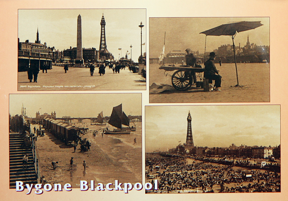
The growth of Blackpool is best understood in the context of conditions in the industrial North of England and with contemporaneous developments in communications. The history of Blackpool has been largely determined by its geographical position in relation to the heavily populated towns and cities of Lancashire, and by the rapid changes in transportation and economic conditions that took place there. The city began attracting holiday visitors in 1735, when the first guest house opened. However it was when the railway arrived, in 1846, that holidaymakers began to arrive in their thousands.
The retro postcard…
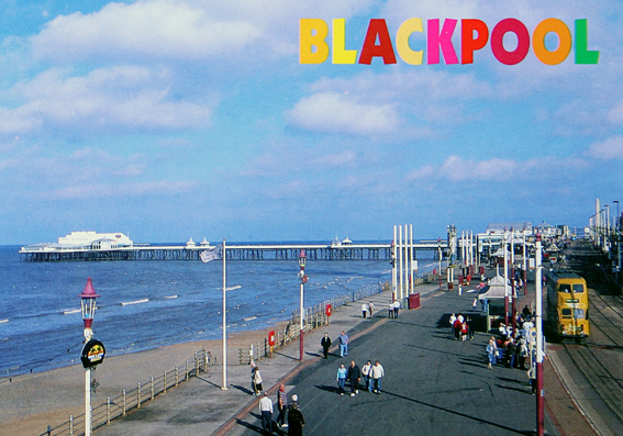
There was a practice among the mill owners of Lancashire towns to close the factories for a period every year to service and repair machinery. These became known as “wakes Weeks”. It is interesting to note that these holidays were not principally intended to give the workers a rest but were mainly to service the equipment.
The feline postcard…
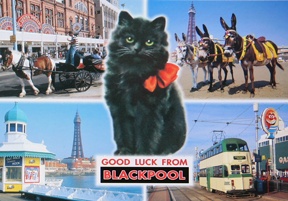
Time off work together with cheap and convenient travel led to large numbers of visitors taking their holidays outside the towns they lived in. Each town would have a different wakes week during which almost the entire population would board the trains and decamp to the coastal resorts of Morecambe, Southport, and of course, Blackpool.
The donkey postcard…

 From the 19th century, Blackpool became a popular working-class destination and it grew at a phenomenal rate. In 1881 it had a population of 14,000. By 1901 the population was 47,000. By 1951 it had grown to 147,000.Â
The humorous postcard…
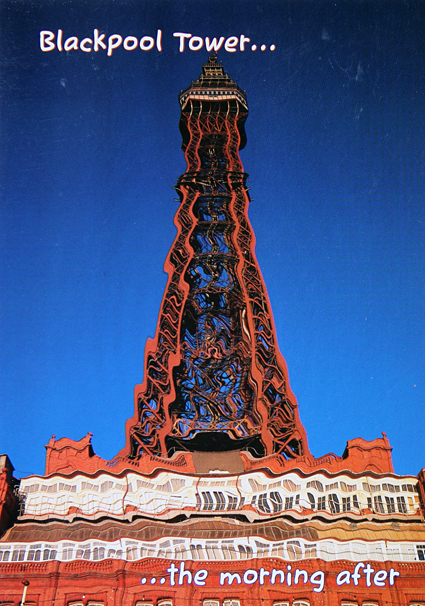
Blackpool is famous for its tower, which was built between 1891 and 1894. However, much of Blackpool’s growth and character from the 1870s on was predicated on the town’s pioneering use of electrical power. In 1879, it became the first municipality in the world to have electric street lighting, as large parts of the promenade were wired. The lighting and its accompanying pageants reinforced Blackpool’s status as the North’s most prominent holiday resort. It was the forerunner of the present-day Blackpool Illuminations.
The boring postcard…
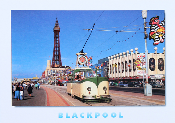
Another major development came when the post-war Labour government introduced paid annual holidays for all employees, boosting tourism in the resort. The inter-war period saw Blackpool attain pre-eminence as a holiday destination. By 1930, Blackpool claimed around seven million visitors per year, three times as many as its nearest British rivals, still drawn largely from the mill towns of East Lancashire and West Yorkshire.
One for the boys…
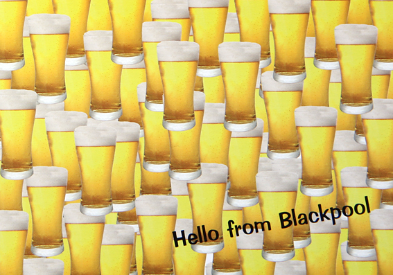
Blackpool was spared serious damage during World War II and in the decade afterwards, it continued to attract more visitors, reaching a zenith of 17 million per year. However, several factors combined to make this growth untenable. The decline of the textile industry led to a de-emphasis of the traditional week-long break. The rise of package holidays sent many of Blackpool’s traditional visitors abroad, where the weather was more reliably warm and dry, and improved road communications, epitomized by the construction of the M55 Motorway in 1975, made Blackpool more feasible as a day trip rather than an overnight stay.
My personal favourite…!
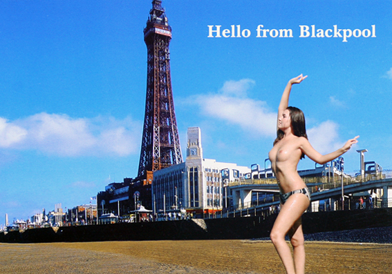
Today Blackpool’s economy remains relatively undiversified, and firmly rooted in the tourism sector. It’s a favourite location for hen and stag weekends and is Britain’s second most popular tourist attraction (over 6 million visitors a year) and was only recently knocked off the top spot by the British Museum.
Â
Posted in PLACES, POSTCARDS | Comments Off on BLACKPOOL & THE HUMBLE POSTCARD
It turns out that the North-South divide I wrote about in my last post has recently been redrawn in a controversial new study. Interestingly, the study was undertaken by one of the Human Geography professors from my old department at The University of Sheffield.
Professor Danny Dorling has devised the line based on a number of more recent socio-economic developments, including rising house prices, increased life expectancy and voting patterns. Dorling’s line says the North begins at the Severn estuary and heads up towards the Humber, hitting the coast in a higgledy piggledy diagonal south of Grimsby.
You can read about Dorling’s study in an article in the Observer and more about his research on British identity (with Bethan Thomas) here.
Â
Posted in PLACES, REPRESENTATION | Comments Off on A NEW LINE FOR NORTH-SOUTH DIVIDE
According to a recent article in The Times, which quoted a survey conducted by Travelodge hotel group, almost 5m southerners have never travelled north of the Watford Gap – and the cultural barrier, often known as the North-South divide, has become an equal deterrent in the opposite direction.
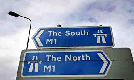
© David Sillitoe/ The Guardian
Â
The North-South divide is not an exact line, but one that can involve many stereotypes, presumptions and other impressions of the surrounding region relative to other regions. The Times article quotes that almost three-fifths of northerners in the survey described southerners as “snobs†while half surveyed associated London and the home counties with “wide boys†and City brokers in “pinstripe suitsâ€. For southerners, the north is a desolate landscape of derelict mining villages and fish and chip shops, and is dismissed by three-fifths as “bleak†and “unsophisticatedâ€.
The existence of the North-South divide is often contested, although the Watford Gap service station is unofficially known by residents of London and southeast England as the point where the north-south divide occurs.
According to wikipedia, it has recently become more popular to use the phrase “north of Watford“, referring to the larger town. The reason for this change is probably due to the signs at Staples Corner, where the M1 begins, reading simply ‘M1, Watford, The North’ thus potentially implying that Watford is the last place in the South.
In his book The English, Jeremy Paxman proposed that the north might be defined as anywhere above a line drawn from the Severn to the Trent. Whereas Stewart Maconie, in his book Pies and Prejudice, suggests the north begins at Crewe station, beyond which point “the geology becomes harder, the accents flatter and the climate wilder. And the surface of the M6 turns from tarmac to cobbles.â€
Having driven past Watford Gap, the Severn-Trent line and finally passing Crewe train station on Friday, we must officially now be in ‘The North’.Â
Â
Posted in PLACES, REPRESENTATION | Comments Off on THE NORTH
Here’s a quick update on our route. Having started the month of July in Bedfordshire, we have since traveled through Northamptonshire and Warwickshire, dipping into the southern part of Leicestershire. Rather than continuing north to Nottinghamshire, as originally planned, we cut through Staffordshire into Shropshire. We’re now in Cheshire and we’ll be heading north into Lancashire next week.Â
Â
Posted in PLACES | Comments Off on ROUTE UPDATE
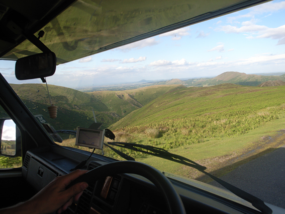
The most impressive vista of the journey so far has to be this view from Cross Dyke looking out over the Longmynd in Shropshire (Longmynd is ‘Long Mountain’ in Welsh).
 Â
Â
Â
Â
Posted in PLACES | Comments Off on LONGMYND, SHROPSHIRE
The Isle of Wight has been making headlines recently with its audacious plans to become the world’s greenest Island. Under the ‘Eco Island’ banner, council leaders are hoping to harness the power of the wind and waves so that by 2013 most of its electricity will come from renewable sources. The bulk will be made up of tidal power, along with on- and perhaps off-shore wind farms. The Island’s ultimate goal is to become completely carbon neutral within a decade and then to produce an excess of renewable energy so they can sell power to the mainland.
Â
Posted in MISCELLANEOUS, PLACES | Comments Off on THE GREENEST ISLAND ON EARTH?
